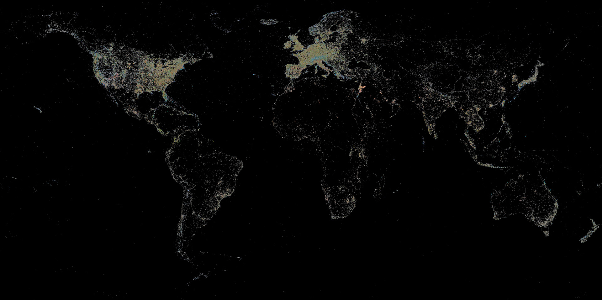
The World Wide Map seeks to answer the question of how the global mosaic of many locally taken photographs can be represented in a legible way as a still image. To do this, the project uses a special algorithmic imaging process that has resulted in a single representation of the billions of images circulating online.
The imaging process is based on the cartographic coordinate system, in which the source images are arranged according to their exact position of creation. Later, the resulting image sets are mathematically averaged to produce the colour value of each pixel of the final image. The imaging algorithm repeats this process pixel by pixel until the entire land surface is scanned.
The large-scale tabletop image produces a distorted world map of millions of source images per pixel, revealing, among other things, the vast digital infrastructure differences between areas. Due to the extremely large amount of data, the “exposure time” of the image was seven months.
2019-2020
World Wide Map #1
Project video
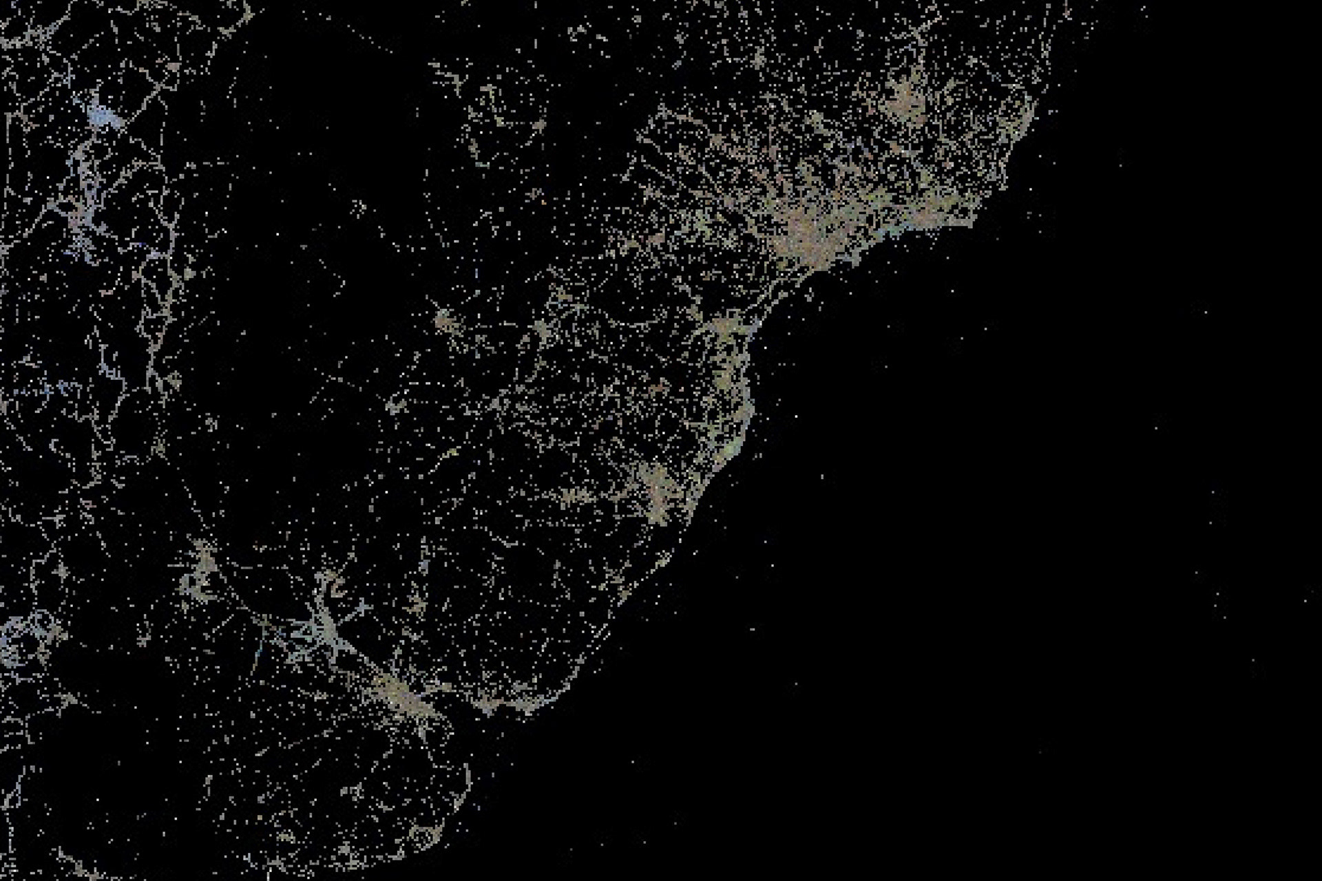
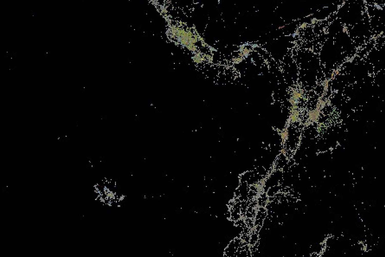
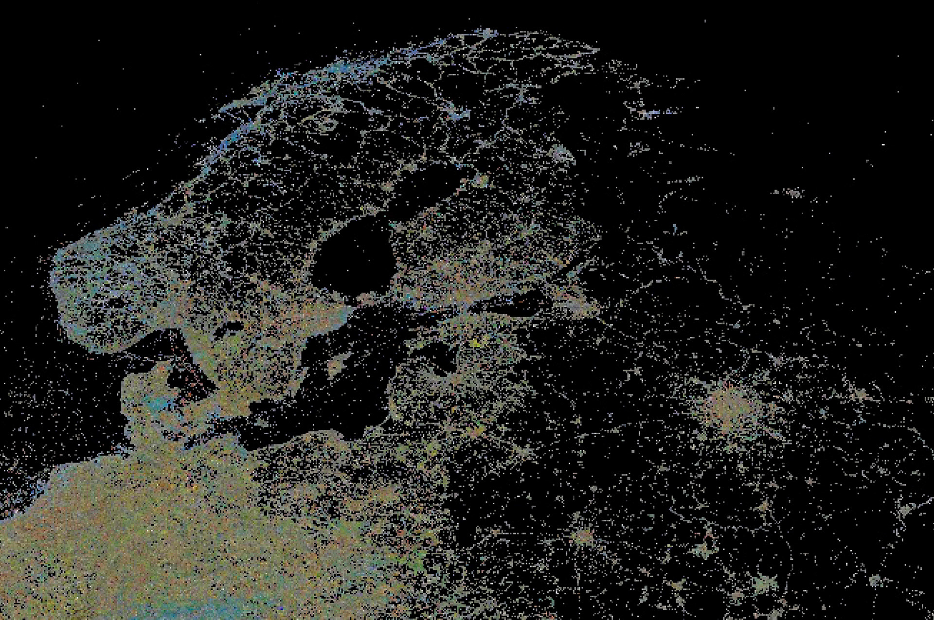
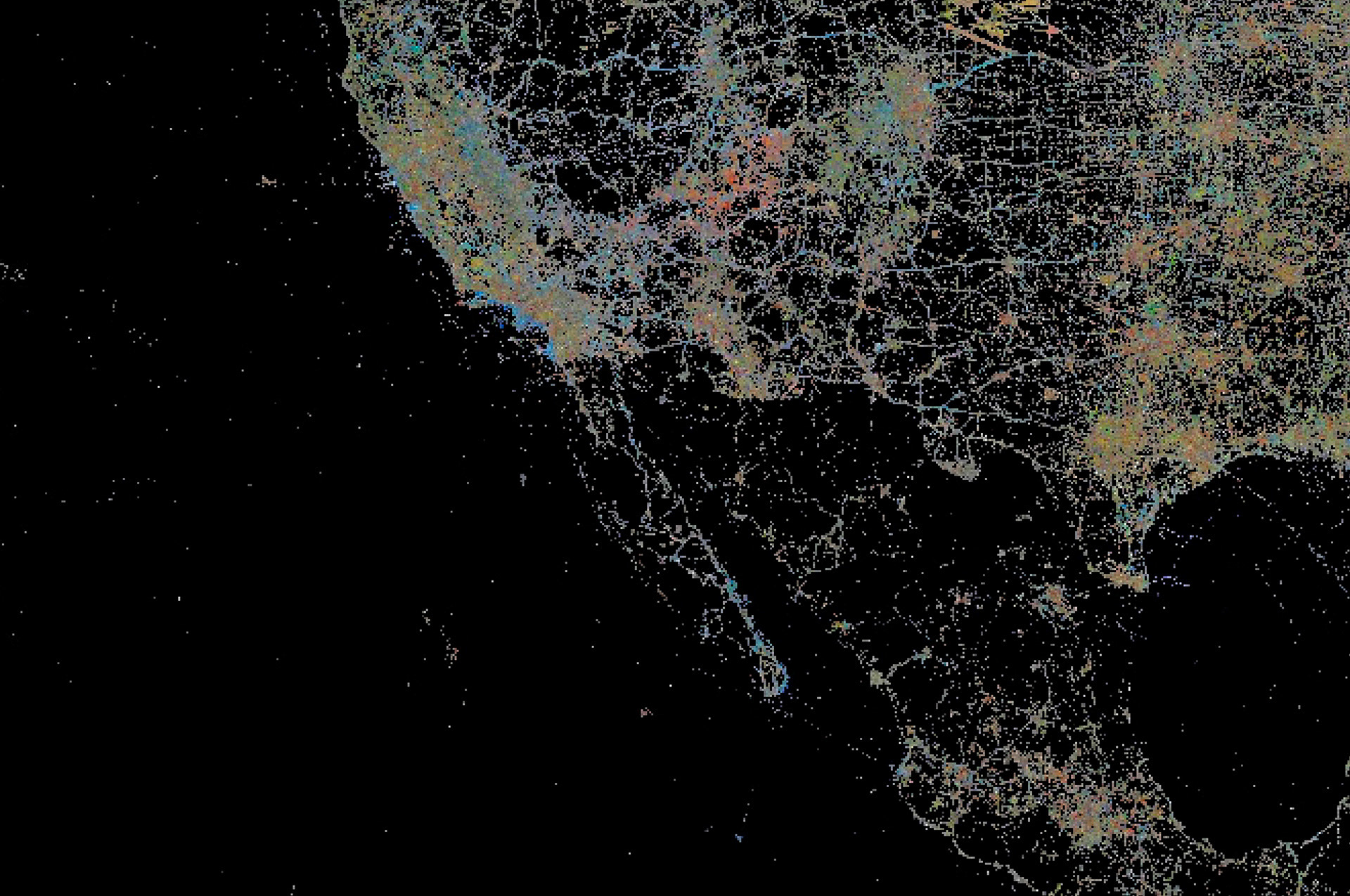
Details of the image World Wide Map #1
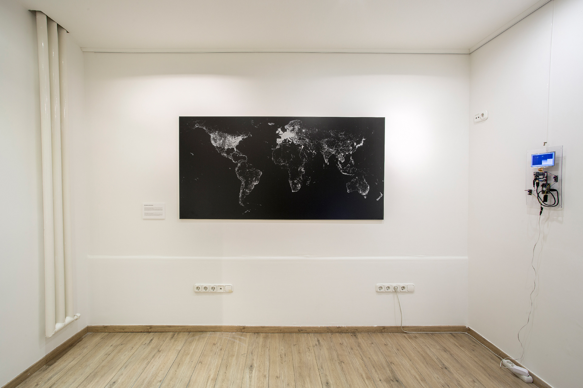
Installation view on the solo exhibition 'World Wide vieW', MyMuseum Gallery, Budapest, 2020.